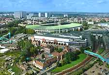
Brussels Airport (BRU)
Driving Directions / Travel by Car
(Brussels, Belgium)
Known locally as 'Luchthaven Brussel', the busy Brussels Airport Zaventem (BRU) is located just a short drive from the city centre. Located on the north-eastern outskirts of Brussels, the airport can be reached in around 15 minutes by car and is sited next to Zaventem. A number of different routes are possible, all of which are well signposted.
The Brussels ring road surrounds the city and will eventually lead to the airport. Situated on the northern side of the airport, the N21 runs in a north-east / south-west direction, close to both Machelen and Melsbroek, while Steenokkerzeel, Erps-Kwerps, Humelgem and Kortenberg all lie to the east, together with the N227 (Mechelsesteenweg). The A201 leads into the grounds of Brussels airport and is located off the A12 and the N262.
On the north-western side of Brussels Airport you will find a number of prominent towns, which include Borgt, Groot Molenveld, Koninglslo, Machelen and Vilvoorde.
Directions to the Brussels Airport Zaventem (BRU) from the centre:
- Travel along the main N21 freeway (Haachtsesteenweg)
- Follow the sign posts towards Brussels Airport Zaventem, along the A201
- The airport can also be accessed off the N262 (Van Dijcklaan).
Brussels Airport (BRU): Virtual Google Maps
