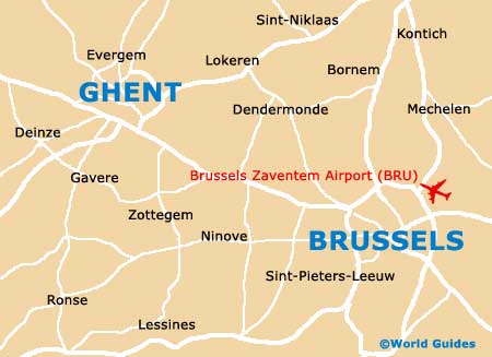
Brussels Airport (BRU)
Orientation and Maps
(Brussels, Belgium)
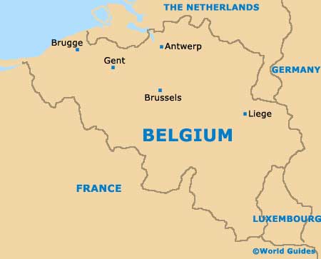
The capital of Belgium, Brussels is located in the centre of the country and is known in French as 'Bruxelles'. An important part of Western Europe, Brussels lies around 48 km / 30 miles south of Antwerp (Antwerpen), with a journey time of roughly 45 minutes.
Those arriving by plane will usually fly into Brussels Airport Zaventem (BRU), which is situated in the city's north-eastern suburbs, next to Zaventem. Surrounding the city of Brussels is a busy motorway (The Ring), which connects many places of interest, including the airport, and makes it easy to reach most parts of the city centre.
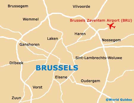
Brussels Airport Zaventem (BRU) Maps: Important City Districts
A smaller ring road encircles Brussels city centre, consisting of a number of interconnecting roads, including the Boulevard de l'Abattoir, the Boulevard du Midi and the Avenue des Arts. This area of the city is split into two main regions, the Upper Town and the Lower Town.
Located on the south-eastern side of Brussels, the Upper Town district is a wealthy part of the city and boasts wide boulevards and a number of grand buildings, such as the Palais de Justice and also the Palais Royal, together with a selection of noteworthy museums, cultural attractions and the Belgian parliament.
The Lower Town area of Brussels is quite different and is based around the historic medieval centre area and the Grand Place square. Lower Town features charming cobblestone streets and a number of lively communities, such as Sainte Catherine, Ilot Sacré and Marolles. The Senne River meanders through this part of Brussels, although these days it is hidden underground.
Belgium Map
Brussels Map